One of the latest endeavors in the world of 360 degree immersive video comes from an organization called Below The Surface, whose Riverview Project is seeking to create a virtual map of America’s waterways.
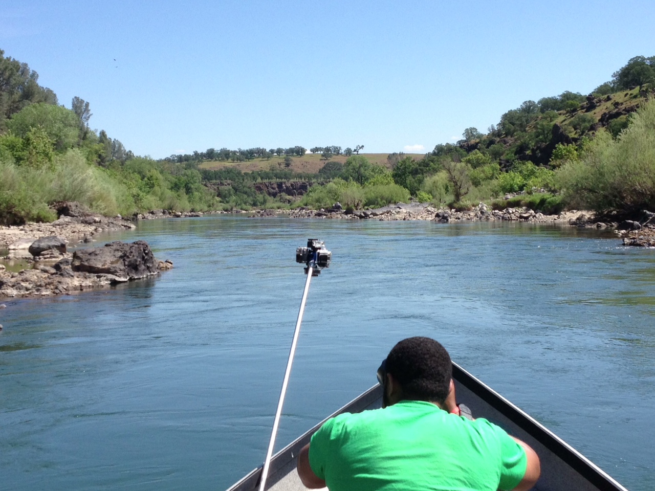
In order to deliver visual information about these rivers to a larger audience, this project is utilizing 360Heros 360 video gear to create an immersive data center. Following a pilot run on the Apalachicola River, the Sacramento River is Riverview’s most recent and more streamlined expedition for this hybrid film and research project.
Riverview is the brainchild of Kristian Gustavson, the Director of Research and Explorations for Below the Surface. As an avid surfer and experienced oceanographer, Kristian has witnessed firsthand the pollution emptying from our nation’s rivers into the ocean. Riverview was born as a medium to raise awareness for waterway conservation via exploration and detailed documentation.
In speaking with Kristian, he highlighted this project’s wide range of goals and practical applications:
“Our goals with the Riverview Project are to generate a baseline of imagery data for America’s waterways, conduct research and gather as much other data as possible in the process. We want to use this information to promote recreation, conservation and future research on our country’s waterways.”
In order to offer a multitude of useful information, Riverview intends to produce an interactive, Google Street View-like map of major rivers in the United States. As users take a virtual tour of a particular waterway, they will also be presented with an overlay of scientific and recreational information. This interface will feature information about river depths, water flows and water quality. GPS coordinates for fishing spots, paddling trails and access points will also be marked with recreational use in mind.
Aside from offering tangible data, Riverview’s main goal is to promote dialogue about America’s rivers. In referencing the task of raising awareness for waterway conservation and education, Kristian pointed to technology as a key tool:
“We tend to fear what we don’t understand, but we also tend to neglect what we don’t fully understand. There’s a lot of information out there right now from federal agencies and researchers that needs to be gathered and made available in the same place. Creating a cyber-infrastructure for waterways is extremely important for accomplishing this; and high-def. panoramic images can serve as a key foundation.”
Riverview seeks to create a multipurpose resource for accessing waterway information. As Kristian noted, the basis for this virtual data center will be 360 degree panoramic video footage that offers a first-person perspective of life on the rivers.
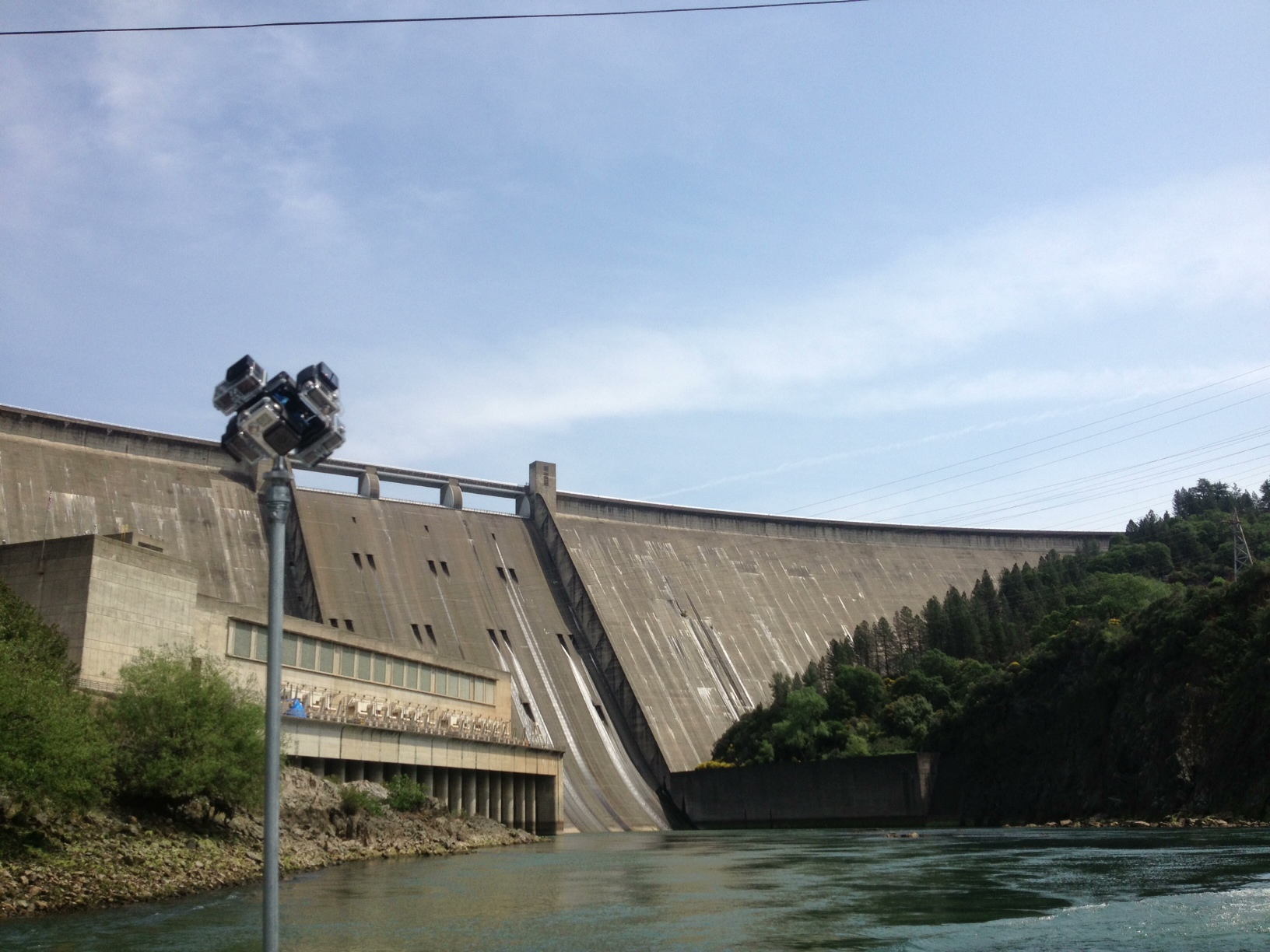
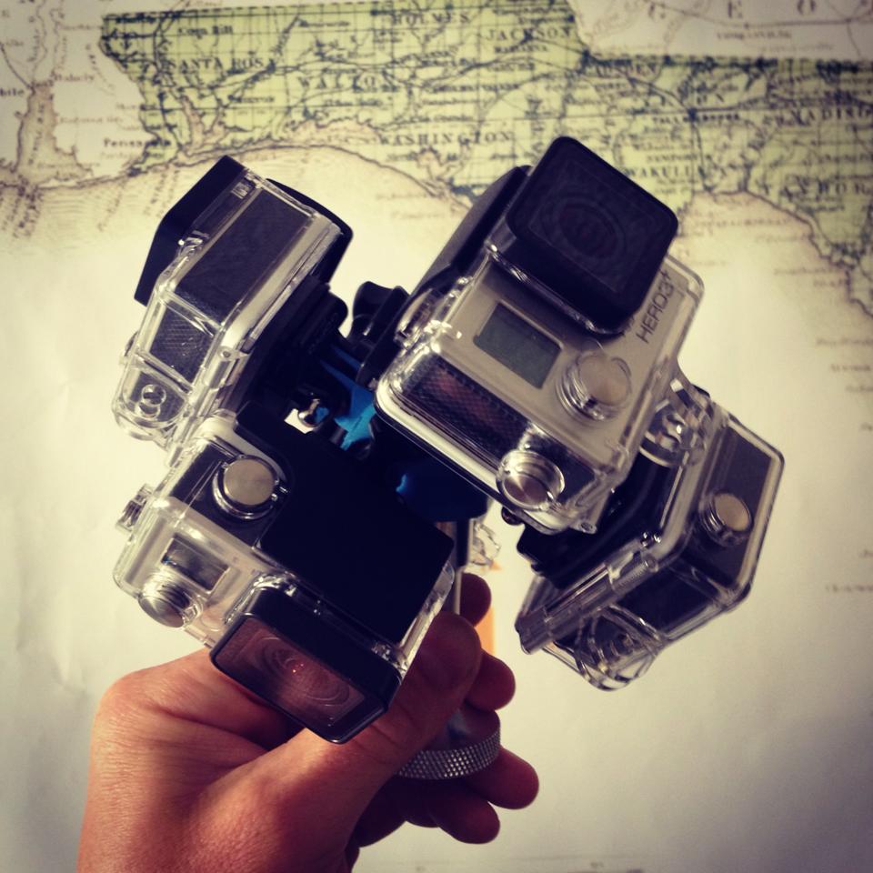
In terms of capturing the panoramic footage necessary to create this interface, Riverview is utilizing 360Heros 360 Plug-n-Play Holders. Having already experimented with other larger camera rigs and different panoramic video systems, 360Heros offers Kristian and Below the Surface the freedom and flexibility their project requires. Specifically, its adaptability in terms of mounting, ease of transport and relatively small data files were helpful:
“360Heros holders are more versatile and adaptable than other mounting options. With this rig we can mount it on more things, take it more places. For instance, we can be filming on a canoe and quickly transition to shooting footage on a larger research vessel. The comparatively smaller size of the gear and the data files gives us a lot of freedom when working on the waterways. I love it, I can’t wait to work with it more. It’s solved a lot of problems we’ve had.”
Having just completed their first filming and mapping expedition on the Sacramento River, the Riverview team is looking to take the next step in expanding the project. According to Kristian, this step involves creating a uniform process for executing expeditions, shooting footage and producing the virtual waterway maps. Also, collaborating with other ongoing projects and expeditions is a priority in order to “get more miles on the map and to get more people to join the dialogue.”
After years of planning, the Riverview Project is officially making headway on America’s waterways as well as a splash in the world of immersive panoramic video. 360Heros is proud to be working with Below the Surface in supporting this project and its worthwhile goals. Stay tuned for more information about this exciting venture and other 360 video news from around the world!
© 2011-2014 360Heros™ is a 360Heros Inc Company. GOPRO®, HERO® are trademarks or registered trademarks of Woodman Labs, Inc. in the United States and other countries. 360Heros, Inc. is not an affiliate of GOPRO® or Woodman Labs, Inc. 360Heros is a very proud user of GOPRO® cameras! 360 Heros creates 360° Video using GoPro Hero2 and Hero3 cameras. Check out our gear, sign up for updates, and explore the 360° videos and 360° panoramic photos created with the different 360 Plug-n-Play Video Gear.
You must be logged in to post a comment.